|
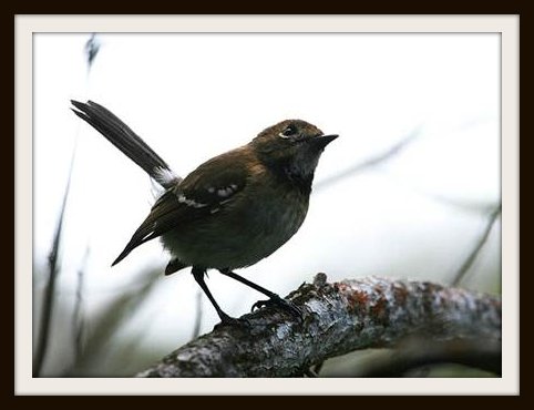
Collected and digitized data such as feature datasets, individual feature classes, along with shapefiles and raster DEM’s were used to compose a project intended to educate the environmentally concerned of the features that contribute to the decline of various plant species and the Oahu Elepaio on the Oahu Island. The features used to create layers that show a correlation between the demise of these species and environmental impacts include Major Land Type classifications, Erosion and Soil Types as well as the Elevation of the endangered habitat. All data collection and archive searches were achieved through the Hawaii Government website readily available for GIS users at http://hawaii.gov/dbedt/gis/download.htm. The purpose of this project serves as an-out-of-the-box effort to coincide with the already proposed approaches of the Honolulu Forest Reserve (DOFAW), Mākua Military Reservation (U.S. Hawaii's Comprehensive Wildlife Conservation Strategy October 1, 2005Army Environmental Division), in Honouliuli Preserve (The Nature Conservancy), and in Lualualei Valley (U.S. Navy and USDA) to protect the endangered habitats. |